Location of Vasilievsky Island. The main attractions of Vasilievsky Island
Hello dear travelers! Vasilievsky Island is the heart of St. Petersburg, the largest island in the city. Its streets are steeped in the history of the Russian state. And Peter I planned to turn it into Russian Venice, but these plans were never realized. What to see on Vasilievsky Island when you arrive in St. Petersburg?
On the streets of Vasilievsky Island, like nowhere else in St. Petersburg, you can feel the atmosphere of the 18th-19th centuries. Some houses look the same as a hundred years ago, so when you find yourself there, you seem to find yourself in the past century.
I don't want to choose either the country or the churchyard. I will come to die on Vasilievsky Island. Your facade is dark blue, I will not find in the dark, between faded lines I will fall on the asphalt, - Iosif Brodsky
In summer, thousands of tourists come to watch the main event of the city - the opening of the Palace Bridge, which connects Vasilyevsky Island with Nevsky Prospekt.
But the locals are not happy with the fact that you can get home at night only by swimming or waiting for the bridges to close. Recently, a night metro line was launched, which brings residents from one bank to another during the opening of bridges.
The weather on Vasilievsky Island differs from St. Petersburg - it is almost always colder and more windy here, so it will not be superfluous to take warm clothes for a walk.
Development history
The history of Vasilievsky Island dates back to the 18th century, when Peter I presented it to A.D. Menshikov. He also built a palace on it, the original appearance of which has been preserved to this day. In 1732 he was transferred to the disposal of the First Cadet Corps. And since 1981, a branch of the Hermitage and an exposition of the times of Peter I have settled here.
They began to actively build up Vasilievsky Island when Peter I wanted to build something akin to European cities.
In 1720, the architect Trezzini presented a project with parallel canal streets, in the spirit of Venice. The idea was accepted, but without canals, and the streets were renamed into lines.
By 1810, the Strelka of Vasilievsky Island was built on the eastern part. The port was moved a little later. We have arranged a place for a cemetery. The Blagoveshchensky bridge was erected. Educational and scientific institutions were opened. They began to actively build up residential and public buildings. Industrial enterprises started working in the north and south of the island. The first tram line was laid.

In the 20th and 21st centuries, by merging with the neighboring island of the Decembrists, the Vasileostrovsky region appeared. Reconstruction of Bolshoy Prospekt was carried out. Highways were formed. The following areas were actively built up: the area of the Harbor, the area of the Western Side, which is the marine facade of St. Petersburg.
At the mouth of the river. Smolenka, after the construction of the Shipbuilders Bridge on it, it was planned to lay out a park called "Window to Europe", however, due to the beginning of the reconstruction, the project had to be curtailed. According to the latest information, the project of the "Window to Europe" park on Vasilievsky Island may see the light of day.
Attractions of Vasilievsky Island
The first thing that guests of the island see are the Rostral Columns on the Exchange Square, built in 1810 and previously serving as lighthouses.

From the very top of the columns, a stunning view of the Spit of Vasilievsky Island opens up.
Spit of Vasilyevsky Island
Arrow - the eastern edge of Vasilievsky Island. This is a complex of architectural buildings, harmoniously combined with the embankment of the Neva.

Here is the narrowest street of the city - Repin and the most picturesque 6th and 7th lines of Vasilievsky Island.
There is something to see on the Spit of Vasilievsky Island:
- Building of the Twelve Collegia built in the style of Peter the Great Baroque and consists of 12 three-storey buildings. Now the St. Petersburg State University and the Pedagogical Institute are working there.
- Stock exchange - the central element of the Strelka ensemble of Vasilievsky Island. It looks like an ancient Greek temple surrounded by 44 columns. Until 2010, the Naval Museum was located inside, today the Museum of Soil Science is still working here, but the question of the further use of the building is still open.
- Palace bridge length 260 meters to the Admiralty. Built in 1916.
- Exchange bridge length of 250 meters connects with Petrogradsky Island. It was completed in 1960, taking into account the proportions and shapes of the Palace.

- Rostral columns built in 1810, decorated with the bows of ships. Previously, they were used as lighthouses, so inside there are spiral staircases to the top.
- Commemorative sign Spit of Vasilievsky Island to the 300th anniversary of the city.
- Floating fountain complex measuring 70 × 70 meters. The maximum height of the central jet is 60 meters. Works in three modes: music, light and music and laser show.
Big, Medium and Small avenue
You can also walk from the Vasileostrovskaya metro station, moving along Bolshoy Prospekt.

Along the way, you can visit:
- St. Andrew's Cathedral ... In the middle of the 18th century, the temple burned down and a new one was erected in its place, in the Baroque style, which has retained its appearance to the present day.
- Church of the Three Saints - the oldest church in St. Petersburg. It was built next to St.Andrew's Cathedral so that in winter parishioners could visit a warmer building.
- Church of St. Catherine - built in the 19th century and long time did not work.
- Church of the Icon of the Mother of God - resembles in appearance the St. Sophia Cathedral of Constantinople and only in 2012 became available for visiting.
On Bolshoy Prospekt, literally every building has a history, for example, house number 6 or the house of the merchant Gromov. At the beginning of the 18th century, a museum of L.N. Tolstoy. After that, there lived a writer - N. Chernyshevsky, and during the war years - Tatyana Savicheva, whose stories about life in besieged Leningrad told about this terrible period of the city.
Today, this building houses Spice Museum.

On Sredny Prospekt you will find:
- Famous Museum of Urban Electric Transport , where you can take pictures of the exposition and visit the inside of the cars.
- Lutheran Church of St. Michael renovated 7 years ago. The parishioners say that the church has good sound and one of the best organ instruments in the city.
- V Museum of Geology over 1 million exhibits, including rare and expensive items.
There are not many attractions on Maly Prospekt, but you should definitely stroll along the streets and enjoy the view of the Annunciation Church.
University embankment
There are 4 embankments on Vasilievsky Island at once: Universitetskaya, Lieutenant Schmidt embankment, Makarov and Morskaya.

There are a large number of attractions on Universitetskaya:
- Zoo museum ... Its collection contains over 50 million items. Among them are a stuffed adult mammoth and a long whale skeleton.
- Kunstkamera - a gallery of rarities, which became famous because of the exhibits of alcoholized freaks, presented in the halls of the museum.
- Menshikov Palace
built in baroque style
the time of Peter I. - Rumyantsevsky garden with fountains and busts of Repin and Surikov.
- Academy of Sciences , erected in the late 80s of the 18th century.
- Academy of Arts.
- Sphinxes installed on the pier in the 30s of the XIX century. In fact, they are over 3,500 years old. Mysterious Sphinxes from Thebes guard the waters of the Neva here. These are the only sphinxes in the city related to art. Ancient egypt.
Lieutenant Schmidt Embankment
Moving along the Universitetskaya embankment towards the Blagoveshchensky bridge, you will find yourself on the Lieutenant Schmidt embankment.

Walking around these places, you can see: Naval and Mining Institute, Church Holy Mother of God and the icebreaker-museum "Krasin", which took part in the rescue operation at the North Pole and the Great Patriotic War.
Mining Museum of the Mining University
The Mining Museum in St. Petersburg was founded on October 21, 1773 together with the Mining School by the decree of Catherine II. It is located on the second floor of the Mining University building. The collections of the museum occupy the best historical halls of the building.
The museum is an important cultural, educational, educational and scientific center of the university. For several centuries, its collections have served as the basis for the scientific and educational activities of the Mining University.

Today the Mining Museum consists of 20 halls, the area of which exceeds 4000 sq. m. The funds of the museum have over 240 thousand exhibits, some of which are unique and rare.
The museum is divided into 3 sections: history of mining technology, mineralogy and geology. Visitors will be able to see the collections of minerals and meteorites collected in the 18th – 19th centuries.
There are also rare products of the Fabergé jewelry company, objects made of steel, copper and cast iron.
Opening hours - Monday-Thursday from 9.00 to 17.00.
Friday from 9.00 to 16.00.
Excursions only as part of organized groups(students, schoolchildren, organizations).
Saturday: only guided tours by appointment for individual visitors (2 groups of 25 people).
Ticket price - Visiting the museum is free. You must have an identity card with you.

What travelers say:
My team and I went on an excursion to the mining museum on one Saturday. To my shame, having lived for so many years in this beautiful city, I have not been to this museum. It was a shock. The exhibits at the exhibition were striking in their beauty. As if plunged into the world of a fairy tale. Wonderfully decorated showcases It can be seen that the museum was created with love. I liked the girl the guide very much. I fell in love with Charoite stone. Most importantly, the museum is free. It turns out you just need to sign up.
Church of the Assumption of the Blessed Virgin
Located on the Lieutenant Schmidt embankment, house 27/2. It was founded in the courtyard of the Kiev-Pechersk Lavra in 1895. The construction was completed in 1903. The pseudo-Russian style gives the temple elegance and lightness.
The five-domed church was erected without the use of columns of brick, concrete, granite, and Radom sandstone. The architect was able to achieve an amazing combination of a monumental cathedral and the comfort of a home church. V.A.Kosyakov managed to harmoniously fit the building into the panorama of Vasilievsky Island.

Accommodates up to 2000 people. Didn't escape the closure. Until 1991, it housed a sports hall and an indoor skating rink, baths and flower plantations.
Divine services resumed in August 1991. From photographs, it was possible to restore the unique porcelain iconostasis.
Museum Icebreaker "Krasin"
Icebreaker "Krasin" - a unique museum under open air, a genuine arctic icebreaker that has traveled tens of thousands of kilometers throughout the world's oceans during its long life. For more than a century of its existence, the icebreaker managed to serve in the Russian and Soviet navies, to work as a convoy ship and a research vessel.

In the last decade and a half, a fairly old, but still strong handsome man is moored to an eternal parking lot at the Lieutenant Schmidt Embankment in St. Petersburg and while away his days in the role of a living museum.
The years of perestroika became a difficult period in the life of the icebreaker. Lack of funding and even attempts to sell a dilapidated ship that had become useless to anyone almost led the Krasin to death.
Thanks to the efforts of caring people and enthusiasts, an organization was found that was ready to sponsor the restoration of the historic ship and its transformation into a museum on the water.
Working hours - Wed – Sun from 11:00 to 18:00 (ticket office until 17:00).
Mon, Tue - days off.
The last Wednesday of the month is a cleaning day.
Ticket price - Entrance ticket (excursion): adults - 400 rubles, schoolchildren, students, pensioners, children from 5 to 7 years old - 200 rubles, children under 5 years old, combatants, conscripts - free of charge.

What travelers say:
We were lucky, we got on an unscheduled excursion (they are usually held every hour -12.00, 13.00, etc.), we had an amazing guide - Diana Borisovna. The story was very interesting, emotional (from the side of visitors). They told the story of the icebreaker, its difference from other ships, you could hold the steering wheel (you can't turn it - the icebreaker is working), knocked on the morse, looked into the captain's cabin. They gave me time to take pictures. Everyone was very pleased with the excursion, we will return in the summer for a walk on the upper deck !! (Were in mid-March).
Other attractions
The Chapel of St. Xenia of Petersburg is the most visited place among believers. It is located next to the Primorskaya metro station, on the territory of the Smolensk cemetery. There is a belief that Ksenia helps everyone who asks her for help.

You can also walk to Lenexpo - one of the largest exhibition complexes in the Russian Federation.
And the sea terminal, located on the Sea Glory Square, is ready to receive any ships.
Bridges
The very first on Vasilievsky Island appeared the Blagoveshchensky bridge.

Later, Dvortsovy, Birzhevoy and Tuchkov appeared. In the summertime, all these bridges are raised in turn according to the schedule, but it changes every year, so it is better to check in advance.
To get to St. Petersburg and Vasilievsky Island, book your plane tickets in advance.
For online booking air and train tickets, as well as hotels and tours, you can use the site Ozon.Travel.
Here you will also receive information about payment for the order and delivery of tickets, tariffs, and availability of seats.
Have you ever been to Vasilievsky Island? Are we missing something? Add your routes in the comments.
See you!
We all know perfectly well cultural capital Russia - St. Petersburg. But not everyone knows about its equally interesting part - Vasilievsky Island. If you are interested in this island, you will definitely want to visit it. So let's decide which sights of Vasilievsky Island are worth visiting in the first place.
A small excursion into history
Vasilievsky Island is the largest on the Neva. Peter 1, having seen the idea in Amsterdam, wanted to dissect the island with many canals. But he failed to bring the idea to life. This was due to many reasons, one of which was his closest associate, Alexander Menshikov. He interfered with the construction and erected a luxurious palace for himself. Despite the tsar's decrees, the people did not move to Vasilyevsky Island. The canals fell asleep. This is the only place in the world where each street has two names. Another important reason was the lack of a road to the island. And Peter 1 did not want to build bridges.
Bridges
Since 1727, a pontoon bridge was installed 2 times a year. Now there is a memorial sign at this place. You had to pay to cross the bridge. The collected money was later built
After some time, the bridge was moved and the first Yablochkov lanterns were installed on it. Later, the bridge was returned to its old place and kerosene lanterns were installed. Because of this, in 1916 it burned down.

By decree of Nicholas 1 in 1850, the Blagoveshchensky bridge was built. After the death of the emperor, it was renamed to Nikolaevsky. The original name returned only in 2007. During the Soviet Union, it was called "Lieutenant Schmidt Bridge". The bridge built next to him was called his "son". Now "the son of Lieutenant Schmidt" is called "Bolshoi Petrovsky Most".
Now we know that the main historical sights of Vasilievsky are bridges. Now let's move on to the rest.
Troekurov's house
It is incredible how this small mansion has survived to this day - a sample of buildings from the time of Peter 1. By this sight of the Vasilievsky Island of St. Petersburg, one can judge the appearance of the streets of the city in the middle of the 18th century. The house was built in the 30s of the 18th century for the emperor's steward - Alexei Ivanovich Troekurov. In 1969 the building was reconstructed. Now in the building of this landmark of Vasilyevsky Island there is an educational complex with its most popular hotel and parking in the city.

House of Academicians
After the opening of the scientific academy on Vasilievsky Island, it became the center of the scientific life of Russia. Academics, of course, wanted to live as close to work as possible. For this reason, a "communal house" was opened here. From here, many scientists left us, which is why the building was nicknamed the "Indian Tomb".
Icebreaker-museum "Krasin"
Icebreaker-museum "Krasin" is a true monument to shipbuilding. In 1917 it was built in England to order for the Russian Naval Ministry and named "Svyatogor". In February 1917 the icebreaker arrived in Arkhangelsk, and on August 1, 1819 it was sunk. Until 1952, the Krasin remained the most powerful ice drift in the world. Now the ship is one of the branches. Everyone can visit the "ship attractions" of the Vasilievsky Island of St. Petersburg, the photos of which you can see below. This is the wardroom, the captain's bridge, the navigator's cabin ...

Church of the Three Saints
The author of this attraction of Vasilyevsky Island, the photo of which you can also see below, is believed to be, but there is nothing left to confirm this fact. The Church of the Three Saints was built in 1760.

Church of the Holy Apostle Andrew the First-Called
In 1780, this temple was built, located as close as possible to the Church of the Three Saints. There is an opinion that it was here that Ekaterina Dolgoruky was buried. In 1917 the temple was plundered and closed. In 1992 it was restored and reopened.

Sphinxes
In 1834, the main facade of the art academy was decorated with two Egyptian sphinxes.

Sphinxes are the most ancient sights of Vasilievsky Island, more than three thousand years old. Once they stood in the avenue of the sphinxes near the palace of Amenhotep 3.
The Sphinxes were found during archaeological excavations under the command of Janis Atonazis in 1820. Since the expedition was sponsored by the English consulate, the Sphinxes went to England. Nikolai 1 bought them for 62,000 rubles. In 1832, the sphinxes arrived in St. Petersburg and were installed in front of the art academy.

Stock Exchange Building
The Exchange building was built after the transfer of the trading port to the island. In 1730 a wooden building was erected. In 1780 it was decided to make it stone. In 1783 the plan was set in motion.
The main facade of this landmark of Vasilievsky Island overlooks Winter Palace... In 1889, the country's first industrial exhibition was held here, where only domestic products were presented.

Griffin tower
This tower full of legends and fictions is not found in any tourist guide, but it is definitely worth a visit. According to the main version, an alchemist once lived here, secretly bringing out griffins. Some even saw their silhouettes at night.
St. Petersburg, the Neva River and one of the most romantic places in the city Vasilievsky Island and its mysterious history. Attractions and mystical places Vasilievsky Island, the mystery of the name, while walking through the greatest attraction of St. Petersburg. According to the plan of Peter the Great, it was here that the construction of the newly erected capital was supposed to begin ...
Vasilievsky Island
I don't want to choose either the country or the churchyard.
I will come to die on Vasilievsky Island.
Your facade is dark blue, I can't find it in the dark.
between the faded lines on the asphalt I will drop.
Joseph Brodsky
The construction of the new capital of the Russian Empire began on the opposite bank of the Neva, on the Fortress Island and on the Petrograd side. From the times of Peter the Great, only five buildings remain on Vasilievsky Island - the Menshikov Palace, the Kunstkamera building (now the Peter the Great Museum of Anthropology and Ethnography Russian Academy Sciences) the building of the Twelve Collegia, and the house in which Domenico Trezzini lived (Universitetskaya Embankment, house number 21 - rebuilt), and a small part of the Old Gostiny Dvor (this is house number 1/1 letter "O" on Tiflis Street). But, let's talk about everything in order.
Vasilievsky Island - brief information
Vasilievsky Island is the largest of the islands of the Neva, cutting it into two largest branches - the Bolshaya Neva in the south and the Malaya Neva in the north. In the west, Vasilievsky Island is washed by the waters of the Gulf of Finland, and in the north, almost parallel to the Malaya Neva, it is separated by the Smolenka River from the Dekabristov Island ( former island Starve). The area of Vasilievsky Island is 1090 hectares (the area of the island is constantly changing due to the alluvial territories). The greatest length that Vasilievsky Island has from north to south is 4.2 kilometers, and its greatest length from west to east is 6.6 kilometers. The height of the island above the Kronstadt Ordinary (sea level) reaches 3.5 meters.
Vasilievsky Island - the mystery of the name
Vasilievsky Island has changed its name many times. I will immediately dispel one legend that Vasilyevsky Island is named after Vasily Korchmin, the commander of an artillery battery located on Vasilyevsky Island. In general, Vasily Korchmin is a real person, not mythical (as many think), but the very circle of his occupations contributed to the generation of many legends around him. He was not only an artilleryman, but an entrepreneur, a builder of fortifications and defensive structures, that is, simply speaking, a fortifier, a tax collector, a builder of canals and culverts (that is, a hydraulic engineer), together with Jacob Bruce invented new weapon systems, was a scout of the Russian Tsar in Europe, the organizer (and by the current producer) of festive fireworks, the inventor of the flamethrower and combat missiles, much more. And indeed, his battery was located on the spit of Vasilyevsky Island - so the legend went from here, they say, the tsar sent him written instructions, and on the envelope he wrote "Vasily to the island." But, the fact is that under this name - Vasilievsky Island, it has been known for a very long time. In the 30s of the 19th century, a study of the old Novgorod scribal books was carried out, and so, in the census register of the Vodskaya pyatina of Lord Veliky Novgorod from 1500, when listing villages, repairs and estates located on the banks of the Neva, Vasilev Island is mentioned (then its name was spelled as follows, according to one version, this name originated from the name of Vasily Seleznya, his manager, mayor from Novgorod), and a document dated 1545, "On the collection of military men and gunpowder from Novgorod and Novgorod lands on the occasion of the Kazan campaign" is written "... a row on Vasilievsky Island with 4 quitrent yards and other villages with 42 yards, it was required to put up 8 horsemen and 7 squeakers, half of the horsemen, and the other on foot, and the potion (gunpowder) was 2 pounds (32 kg) and 4 large hryvnias." And the connection between the name Vasilyevsky Island and the name of Vasily Kormchin is a historical blunder launched by the first Andrei Ivanovich Bogdanov in his, unpublished during his lifetime, book "Supplement to the history, geographical and topographic description of St. Petersburg from the beginning of its establishment, from 1703 to 1751" , pruflink -.
Briefly, the history of the change in the names of Vasilievsky Island is as follows.
Vasilievsky Island (from 1729 to the present day)
Preobrazhensky Island (May 20, 1727-1729) - by order of Peter II, who planned to place the Preobrazhensky regiment on the island.
Menshikov Island (1720-1727) - the same Danilych ...
Prince's Island (1710-1720) - by the title of His Serene Highness Prince Alexander Danilovich Menshikov.
Dammarholm (Pond Island) - this is how it is marked on one of the Swedish blueprints, circa 1698.
Smolensk field (in the early years of the founding of St. Petersburg)
Hirvisaari (until the 18th century) is a Finnish name translated as Losinny Island.
Vasilievsky Island (since 1500)
There is, however, another theory, which borders on delusion, about the origin of the name Vasilievsky Island from the Finnish word Vasikkasaari, which means Veal Island.
A little more about the name, or rather about its correct spelling.
By the way, there is an opinion that the people of Vasilievsky Island are affectionately called Vaska. So this is not so, although sometimes people who are new to him really call him that, and Vaska is called the Vasileostrovskaya metro station. Although, now, as the classic said: "... everything is confused in the Oblonskys' house ...", maybe now they call him that - a lot has changed in St. Petersburg.
How is Vasilevsky or Vasilyevsky Island correct?
And how to write correctly - Vasilevsky Island or Vasilyevsky Island - with a soft sign or without a soft sign? So, according to the rules of the Russian language, - Vasilyevsky Island, with a soft sign. But the adjective formed from this phrase is always written without a soft sign - Vasileostrovsky.
And here is a question of a slightly different plan - how to write correctly: "Vasilievsky Island" or "Vasilievsky Island". Is the word island in the title spelled with a capital or small letter? Of course, Vasilievsky Island will be correct, that is, not with a capital, but with a lowercase letter.
And a little more from the rules of the Russian language: "Is it necessary to use extensions (the letter" th "separated by a hyphen) when writing the names of the lines of Vasilievsky Island?". So, according to the rules of punctuation of the Russian language, if the numbers are read as ordinal numbers, then it is necessary to use the letter extension, that is, it will be correct "on the 7th Line of Vasilievsky Island", and on "on the 7th Line of Vasilievsky Island" it will be wrong.
Vasilievsky Island - history, planning, architecture
Vasilievsky Island is an amazing place. It is almost impossible to get lost on it even if you get on it for the first time. The uniqueness of the linear layout created by Domenico Trezzini is ingenious in its simplicity - the main street layout, thrown by a rectangular grid on the plan of the island, will never get confused - 29 lines cross three avenues, Bolshoy, Small and Medium from Nalichnaya street to the embankment and, moving along any of them , sooner or later you will find yourself on the avenue or the embankment (or moving along the avenue you will always find yourself on the line). It is worth noting that the line is not a street as many believe (these are not synonyms), but only one side of it (except for the name lines, Kadetskaya, Birzhevaya, etc.). But about the lines, as well as the myth about the channels in their place - a little later.
The names of the three main avenues of VO appeared thanks to His Serene Highness Prince Alexander Menshikov, who ordered to cut a clearing from his palace to the west, to the Baltic Sea. This glade was called Bolshoy Pershpektiva, and later - Bolshoi Prospect. The other two avenues were named after him.
To be precise, the first draft of the layout of Vasilievsky Island was drawn up by the French architect Jean Baptiste Alexander Leblon in the Russian service. But his project was not approved and Vasilievsky Island began to develop according to the plan proposed by Trezzini.
In 1703-1715, the territory of Vasilyevsky was practically not built up, the corpses of workers were brought here, to the western part of the island, and who died during the construction of the city like flies - in thousands, later on this place the Smolensk cemetery was founded, and the Vasilyevsky island itself was at that time Smolensky field, but not by the name of the cemetery, but by the name of the Smolenka River, from which the cemetery also got its name. In 1710-1720, on Vasilievsky Island, on the banks of the Neva, the first stone building of St. Petersburg was built - the Menshikov Palace for Prince A.D. Menshikov. On the famous Spit of Vasilyevsky Island, there was originally an artillery battery, which, together with the guns of the Admiralty, blocked the navigable channel of the Neva, and later, when the center of naval defense was moved to Kronstadt, on the island of Kotlin, wind sawmills were built here. The development of the territory began in the mid-1710s, when Peter the Great came up with the idea to create on the island a city similar to the cities of Europe - St. Petersburg. According to the projects developed in 1716, 1718 and in the 1720s by the architect Domenico Trezzini, a network of parallel streets and avenues intersecting them was planned, which became the basis for further development.
In the eastern part of Vasilievsky Island and near the Bolshaya Neva embankment, the main residential and public buildings are concentrated: the building of the Twelve Collegia, the Kunstkamera, the building of the St. Petersburg Academy of Sciences and other notable houses. Since 1737, the island has been included in the Vasilevsky part of St. Petersburg, and September 15, 1737 is considered to be the birthday of the Vasileostrovsky district of St. Petersburg. In the 1730s, the port of St. Petersburg was moved here, which stimulated the further development of Vasilievsky Island.
Since the beginning of the 19th century, an important architectural ensemble becomes the area of the Spit of Vasilievsky Island. In the late 18th - early 19th centuries, almost all scientific and educational institutions of the city were concentrated on the island: the St. Petersburg Academy of Sciences, the Library of the Academy of Sciences, the Academy of Arts, the Mining Institute, the Naval Cadet Corps, St. Petersburg University.
In 1843-1850, the first permanent bridge across the Bolshaya Neva was built - the Blagoveshchensky bridge, connecting Vasilievsky Island with the Admiralty side. In the second half of the 19th - early 20th centuries, active housing construction was carried out on Vasilievsky Island. In the southern and northern parts of Vasilievsky Island, a number of large industrial enterprises arose (factories: Trubovochny, Siemens-Halske, Cable, Siemens-Schuckert and others, the largest is the Baltic plant), and on September 29, 1907 (September 16, old style ) tram cars started their first regular runs from the oldest tram park in the city of Vasileostrovsky tram depot - now the Museum of Electric Transport is located in the historical hangars of this tram depot.
In 1917, Vasilievsky Island and the neighboring Golodai Island (now Dekabristov Island) became part of the Vasileostrovsky District (in 1936-1961, a part of Vasilyevsky Island to the west of the 12th and 13th lines belonged to a separate Sverdlovsk District).
In the 1920s, the reconstruction of the western part of Vasilievsky Island began. In 1950-1960, the development of the Harbor area was continued and the reconstruction of Bolshoy Prospect of Vasilyevsky Island was carried out. At the end of the 1960s, a new district began to form in the western part of Vasilievsky Island (it was built on reclaimed territories), which is the marine facade of St. Petersburg, including the Marine Station - the center of the ensemble of the Square of Morskoy Glory, Morskaya Embankment, the Pribaltiyskaya Hotel.
The new development of Vasilievsky Island is being formed along with the advancement of alluvial territories to the west, towards the Gulf of Finland, from Nalichnaya Street, the name of which corresponds to the meaning of the word "embankment", but which has not been directly connected to the sea for a long time. To the west of Nalichnaya Street, new practically meridional encircling highways are being formed - Korablestroiteley Street and the unfinished Morskaya Embankment (which, due to further land reclamation at the beginning of the 21st century within the framework of the Marine Facade project, also loses its relevance). To the west of the latter, in the second decade of the 21st century, a section of the Western High-Speed Diameter route is being built, which should connect the northern and south coast Gulf of Finland.
The isolation of Vasilievsky Island from the rest of the city has formed a special psychology among its residents: you won't come home on time, you won't get home - the bridges are divorced ...
Vasilievsky Island is connected with the city center (Admiralteisky Island) by the Blagoveshchensky and Dvortsovy bridges, and Tuchkov and Birzhevy bridges to the Petrograd side. Five bridges - the Korablestroiteley bridge, Nalichny bridge, Novo-Andreevsky bridge, Smolensky bridge and Uralsky bridge, Vasilyevsky island is connected to the Dekabristov island. The planned construction of the Novo-Admiralteisky Bridge (the name is conditional, the people call this line - the Crossing of Strife) in the alignment of the 22-23 lines of the VO has been frozen due to a reduction in city budget revenues.
A project is being developed to build a bridge from Dekabristov Island across Serny Island to the Petrogradskaya Side, which will link Vasileostrovsky and Petrogradsky districts to duplicate two other congested bridges, especially in the run-up to the 2018 FIFA World Cup.
There are two metro stations on Vasilievsky Island - Vasileostrovskaya and Primorskaya. Construction of the entrance to the Sportivnaya station from Vasilyevsky Island through a tunnel under the Neva from both ends of the Tuchkov Bridge has begun.
Do you know that…
And in St. Petersburg there used to be a rock group, Vasilievsky Island, performing beautiful melodic pop-rock.Vasilievsky Island lines
It must be said that the lines of Vasilievsky Island are not a unique phenomenon in the history of urban planning both in St. Petersburg and in other cities. Similar principles of street design are found in the annals of architecture. But precisely due to the fact that St. Petersburg is the first city in Russia that was built according to the plan and had a clear urban planning concept, and also due to the fact that our city became one of the main tourist centers the world, the lines of Vasilievsky Island became one of its business cards and one of its architectural synonyms.
After visiting Amsterdam, Peter I was fascinated by its canals and dreamed of creating a semblance of this city in his new capital. One of his passionate desires was to create a network of canals as in the capital of the Netherlands, the Netherlands. But the realities of the Neva lands - the soil, the high cost of land, and most importantly - the climate, make him abandon this idea. Read more about the mythical "canals of Vasilievsky Island" below.
The ingenious Swiss Domenico Trezzini, and at that time an unknown architect, created a plan of St. Petersburg on the basis of a linear layout of the streets. From north to south, the island is crossed by parallel streets, and from east to west - wide avenues. All this creates a geometrically correct linear structure in the form of a rectangular lattice thrown on the plane of the island. By the way, we see something similar on Leblond's non-incarnate plan.
The very name "Line" comes from the Latin word "lineo", which translates as "straighten", "align", but its derivative - "lineatus", translates as "striped", which figuratively characterizes the layout of Vasilievsky Island.
You know, on these demonic Internet of yours, a version is wandering about that the word "lineo", translated from Latin, means - "lane" or "back street". Do not believe this - this is a fake invented by A.G. Vladimirovich, A.D. Erofeev in their book “Petersburg in street names. The origin of the names of streets and avenues, rivers and canals, bridges and islands ”which was published by the publishing house AST, Astrel-SPb, VKT in 2009. I leafed through it - there is a blooper on a blooper, and historical nonsense, drives it with a historical fake ...
It is believed that the fact that linear streets on Vasilievsky Island consist of two lines (that is, in fact, each side of the street is, in fact, an independent street) indicates that these are supposed embankments. No, this is a tribute to the maritime tradition, symbolizing the right and left sides of the ship - Vasilievsky Island is not for nothing called the marine facade of St. Petersburg. The strange numbering of houses in the city is also connected with this. For more details on house numbering, see here, pruflink -.
In general, apparently, initially the word "line" was supposed to be applied to all highways of the city, which implied the absence of the word "street" as such. So in the first Description of St. Petersburg, along with the streets, the "Millionnaya Line" is mentioned - the current Millionnaya Street, as well as several Embankment Lines, several Stone Lines and the Second Lugovaya Line. But over time, the name "street" still prevailed, and the Lines remained only on Vasilievsky Island.
So let's start, for the first time the name "Line" appears in 1710. Let's take a quick look at the history of the lines, but not in order, but start with the named lines.
Mendeleev line. This street stands alone, it does not include the numerical numbering of the lines, that is, the counting is not from it (the counting of the digital lines is from the Cadet line, the same, by the way, nominal). In the first years of the construction of St. Petersburg, a canal was dug in its place, but not to make a dream come true, but to drain the site for Kollezhskaya Square. As soon as the drainage was performed, the canal was filled up. At the end of the 19th century, Kollezhskaya Square disappeared during the development and only a small Mendeleevsky Square remained from it. This street itself was originally called the Collegiate Line, in fact it was part of the Exchange Line, but in 1849, it became independent and was named the University Line. On October 6, 1923, the University line was renamed into the line named after Professor Mendeleev, but the people adopted a shorter name - Mendeleev line, which eventually became official.
Exchange line - got its name from the exchange warehouses located nearby, in Birzheviy lane. The official name was given in 1798.
Cadet line. It was named so since 1737 for the First Cadet Corps, which was housed in Menshikov's palace after he fell into disgrace. From 1918 to 2007, it was called the Congress Line, since here, in the Menshikov Palace, the First All-Russian Congress of Soviets of Workers 'and Soldiers' Deputies was held at which V.I. Lenin.
Leather line. And she's just not a line. It is a curved arc with an elongated end located in Chekushi. The name was given due to the fact that the tannery was originally located here. By 1852, 9 tanneries were built here. The name was officially recorded in 1854.
Oblique line. This is the last named line on Vasilievsky Island, it is also located in the historical area of Chekushi. It is so named because it is not perpendicular to Bolshoi Avenue, but goes to it at an oblique angle.
Next, let's move on to the number lines. The digital code of St. Petersburg, here, looks like this.
Initially, lines 1-3 went from the Neva to Malaya Neva, lines 4-17 - from Neva to Smolenka, lines 18-23 - from Neva to Bolshoy prospect, lines 24-25 - from Maslyanoy canal to Kosaya line , 26-27th lines - from the Neva to the Kosaya line. The 23rd line in 1774-1778 the 23rd line was called Matisovskaya, since in its alignment there was a transport across the Neva to Matisov Island.
In 1812, the 18-19th line was extended to Maly Prospekt. In 1836, an attempt was made to assign different names to the last four lines: 24-25th - Kotenev Street, and 26-27th - Novoprolozhennaya Street, since there was virtually no passage along them until that time. But the stubborn Vasileostrovians, wishing to preserve their linear identity, did not accept the names and these names never entered into use.
As the development of the Smolensk field, located between the main part of Vasilyevsky Island and the Gavan, the lines located here lengthened. In 1890, lines 20-21 were extended to Sredny Prospekt. The next year lines 22-23 were extended to Sredny prospect, 24-25 lines - beyond Bolshoy prospect, but not reaching Sredny, 26-27 lines - to Bolshoy prospect. In 1908, lines 26-27 were extended further north, to the place where Sobchak Square is now (in front of the Kirov Palace of Culture) and where they end now.
In October 1918, the 15th line was renamed Vera Slutskaya Street. In Soviet times, the cotton-printing factory “I.A. Voronin, Lutsh and Chesher "(Kozhevennaya line, 34) also bore her name (now" Northern Textile "). The name of Vera Slutskaya was also given to the hospital of St. Mary Magdalene, located on the 2nd line. Unlike the factory and hospital, which retained the name of the revolutionary until the 90s, the new name of the 15th line did not take root. Already in the 1930s, the name "Vera Slutskaya Street" completely disappeared from the city maps.
In the 1930s, lines 24-25 were extended to Sredny Prospekt, and in the 1960s to Maly. In the 1940s, the section of the 26-27th lines from the Neva to the Kozhevennaya line disappeared, and in the 1960s, the section of the 14-15th lines near the Smolenka River.
On February 27, 1989, two more lines appeared - the 28-29th. So, by analogy with the previous ones, they named a small passage passing west of the 27th line from the Pokrovskaya Hospital to Sredny Prospekt.
Are there still such streets in St. Petersburg? There are many. If you look closely at the city map, you will see that, in fact, the entire city is organized according to a similar street layout system. But, the basis of the urban planning concept of St. Petersburg was the ray system. Developed by the architect P.M. Eropkin. This is the famous Nevsky trident (Gorokhovaya street, Voznesensky and Nevsky avenues) crossed by arcs of streets and canals with rivers. Therefore, within this structure, parallel lines are not so striking. They seem to be interspersed with islands in the radial-arc highways of the city and therefore do not create the impression of a uniform rectangular grid, like a uniform linear rectangle of Vasilyevsky Island. Of the numbered streets that have ordinal numbers in their name, the most famous are the following:
Krasnoarmeyskaya street (from 1st Krasnoarmeyskaya to 13th) in the Admiralteisky district near Tekhnolozhka (originally these were Izmailovskaya streets, numbered by the companies of the Izmailovsky regiment)
Sovetskaya Street (from 1st Sovetskaya to 10th) in the historical district of Peski, now it is central District(originally these are Christmas streets by the name of the police unit).
Upper lane (from the 1st Upper lane to the 8th) in the historical area of Parnassus.
Of the toponyms of highways of non-parallel location, these are 1st and 2nd Alekseevskaya streets, 1st and 2nd Nikitskaya streets in the Primorsky district. There is also an interesting topographic artifact with the word "line" - these are the names of the type "1st Line of the 2nd half". In this historical district of Kolomyagi, when dividing the streets of the same name, it is customary to divide them into halves.
In addition, there is Rybatsky Proezd (from 1st to 3rd), these are under construction passages in the Vesyoliy settlement near the Rybatskaya metro station.
In general, there was such a comic riddle in Leningrad: name 50 city streets in a minute. You say - 27 lines of Vasilievsky Island, 13 Krasnoarmeysky streets and 10 Soviet streets. But, since 1989, as you know, there are 52 of them ...
As you can see, in terms of urban planning, this is not a rare phenomenon, but, nevertheless, all over the world the word "line" in the sense of "street" is associated with only one place whose name is Vasilievsky Island.
Who are Linear Vasilievsky Island?
Linear is a long-disappeared youth subculture of Vasilievsky Island. She was akin to punks from Ligovka, gopniks, but unlike them, she was distinguished by increased intelligence. Call them youth gangs, of course, the language will not turn, just young people living in VO clustered together, gradually they developed a kind of code and ethics of behavior. For example, if you go up to them and ask for a cigarette, they will give you a cigarette, but at the next request for a match or a lighter you could get in the teeth after listening to the explanation along the way that it is indecent to ask the same person twice. From their appearance, they were usually distinguished by a long scarf.
Actually, their history began even before the revolution, when youth gangs from Golodaya opposed Vasinsky, the line of demarcation of possessions ran along Maly Prospekt V.O. It came to murders. The authorities stopped their activities. But, as they say, the habits remained. In Soviet times, they took on a different form and street aesthetics.
Since the mid-80s, other youth movements began to appear on Vasilievsky Island, as in the whole city. On Poganka, they began to hang out much like rougher metalheads and this subculture began to fade away. The last time I heard the word "linear" was in the winter of 1991.
Well, and the name "linear", as you know, they got along the lines of Vasilievsky Island.
Vasilievsky Island and Joseph Brodsky
At the very beginning of the essay, I gave, as an epigraph, two quatrains from the poem "Stanza". They describe this insular area of St. Petersburg very pathetically.
You know, there was such an anecdote in Leningrad: “ Boris Pasternak is summoned for interrogation by the KGB, and, among other things, they are asked:
- Do you know this Joseph Brodsky?
- I heard, he says.
- Perfectly! What does he do? Where does he live?
- I don't know where he lives, but I know that to die he constantly goes to Vasilyevsky Island».
But, I, a little not about that. If we remember that in reality Brodsky chose to die not at all on Vasilievsky Island in St. Petersburg, but in Greenich Village in New York, but a "churchyard", he made a reservation for himself in Venice, moreover, when the USSR, which he hated, had already more than four years since it did not exist, which means that there were no obstacles to "dying on Vasilievsky Island", then the frankly weak, in its literary technique, the poem "Stanza" is also perceived as fake in content ...
And the fact that there are no dark blue facades on Vasilievsky Island is another matter.
Where have the channels of Vasilievsky Island gone?
In historical, near-historical, and in virtually any literature dedicated to St. Petersburg, there is a legend that the current Lines of Vasilievsky Island are canals that were dug in 1717, in the absence of Peter I, but then, they got littered, shallow and were filled up, turning into streets ... According to another version, the canals began to be dug, but they stopped, because they realized that the floods of the overflowing Neva River would flood the island. According to the third version, the canals began to be dug, but the money allocated from the treasury was stolen by the "thieving" Menshikov, the canals were filled up, and Danilych was once again hit on the back with the famous Peter's club.
So, no one dug any canals on Vasilievsky Island, and did not plan.
No, well, you take a look at the map of Vasilievsky Island and imagine canals in place of Lines and three avenues ... - the island will become completely non-functional, it will be cheese with holes.
After a trip as part of the Grand Embassy to Europe, Peter the Great really dreamed of building his new capital in the image of Amsterdam with its many canals. But then dreams, fantasies ... It seems that Domenico Trezzini initially, even, made a plan with canals dissecting the vastness of the island. But he was rejected - firstly because of its exorbitant high cost, and secondly because of its absurdity - Peter the First was a sober-minded and very practical man. He understood perfectly well that the canals dug here here would make Vasilievsky Island a beautiful, but useless toy, and not an administrative center. Later, when V.O. was moved from the Petrograd side sea port Trezzini has once again revised the island's development plan. According to it, it was planned to dig two canals in the area of the Strelka of Vasilievsky Island, but even this was not implemented since this would reduce the functionality of port services. And it was a little expensive ...
So where did the historical myth about the canals on Vasilievsky Island come from? As it turned out, its source is the fundamental work "History of St. Petersburg from the founding of the city" in 1884, which was written by publicist and historical journalist P.N. Petrov (1827-1891). This book is popular as one of the main sources for the history of the city. But, here professional historians subject it to serious criticism.
This is exactly what happened with “canals in place of lines” - it was Pyotr Nikolayevich Petrov who invented this story. But in 1918, Russian and Soviet bibliographer and journalist P.N. Stolpyansky (1872-1938). Stolpyansky, in his work “How St. Peter-Burkh arose, was founded and grew. Pg., 1918 ", convincingly refuted the widespread version of the canals on Vasilievsky Island, allegedly dug in 1717 in the absence of Peter, read in detail here -.
I must say that Petrov's book is actively cited by the historians of St. Petersburg, but here's what interesting turned out. Any historical work, always, is based on historical and archival documents or practical data, as a rule, this term refers to archaeological excavations. But, the founder of St. Petersburg archeology is the outstanding Soviet archaeologist A.D. Rook, and the first archaeological excavations in the city were carried out only in the 50s of the 20th century. Hence, the data of archaeologists P.N. Petrov, who published his book in 1884, could not use it by definition. But the archival documents ... Hmm, then there was interesting story- it turned out that many of the archives used by P.N. Petrov "were lost." What is meant by this wording is unclear. And yet, reconstructing the history of old Petersburg, P.N. Petrov, actively, with the memories of his contemporaries. That is, speaking about the first years of the construction of St. Petersburg, he used sources like "my mother's grandmother said that ...". Sorry, but this is not a historical source ... We read Petrov's book here, pruflink - "".
So what about the channels? The layout of Vasilievsky Island was originally planned in the form of a rectangular grid of streets, but we must not forget where St. Petersburg was built - it is heavily watered and often swampy soil. Therefore, in the first decades of the construction of the city on the Neva, drainage ditches were dug along almost every street. This was done for almost all streets of the city, and not only for the lines of Vasilievsky Island. Over time, due to their uselessness, they were filled up (the last diversion ditches were filled up in the 70s of the 19th century).
This prompted P.N. Petrov to the creation of a legend. Moreover, she is so romantic and fits perfectly into the mythology of the Northern Capital.
By the way, P.N. Petrov "discovered non-existent canals" not only on Vasilievsky Island. He considered that the large width of Liteiny and Voskresensky avenues, as well as Zakharyevskaya, Sergievskaya and Tavricheskaya streets, is explained that these are also former canals. At the same time, all those citing this nonsense do not pay attention to the fact that in the book of P.N. Petrov, this is presented not as a historical reality, but simply as the author's reflections.
The legend of the canals proved to be very tenacious. So, for example, in the monograph by A.V. Bunin's "History of urban planning art", it is resurrected again.
As already mentioned, Stolpyansky convincingly refuted the widespread version about the canals on Vasilyevsky Island, it was he who first critically approached the work of Petrov. However, criticizing Petrov and P.N. Stolpyansky could not deviate from his point of view, which is evident in relation to his "Descriptions" of Petersburg in 1710-1711 and 1716-1717. Stolpyansky also has major mistakes, which are the result of a superficial study of the documents.
And then I will reveal to you a terrible secret, which Captain Obviously told me in secret. The books of both authors are not historical works. The fact is that P.N. Petrov and P.N. Stolpyansky are not professional historians. Both of them are journalists who do not know how to work with archival documents and interpret historical facts.
Their books are written, indeed, very popular, with a clear desire for entertaining presentation, and, as a result, they are not research work... Yes, they are great connoisseurs of the history of St. Petersburg, but the main source of their works are printed publications, since he was very little involved in archives. Nevertheless, their works provide a lot of new information on the history of the city, opening a new point of view on some issues of local history of St. Petersburg.
The well-known Soviet archivist, bibliographer, source expert and bibliologist, Doctor of Historical Sciences Sergei Pavlovich Luppov analyzed in detail and substantiated the erroneousness of these statements in his monograph on the initial stages of the construction of St. Petersburg, we read here, pruflink - "". And also in the seven-volume edition "Essays on the History of Leningrad", vol. 1. (1703-1861), published in 1955.
By the way, the book by A.I. Bogdanova sins the same mistakes. But it is worth noting that Bogdanov was not a historian, but a bibliologist, and his book is not a scientific study, but "Description of St. Petersburg."
But the scientific study of the history of St. Petersburg by professional historians began only under Soviet rule in the 50s of the 20th century, when the city was preparing for its 250th anniversary.
Vasilievsky Island - legends, myths and mysticism
Vasilievsky Island, like no other district of St. Petersburg, is shrouded in myths, riddles, myths and surrounded by a dense veil of mysticism. And it is not surprising that it is called the island of unsolved mysteries, legends and strange tragic events.
In antiquity, in the pre-historical era, ancient temples were located here, various magical ceremonies and rituals were performed, the ancient wise men lived here. Somewhere here, in the woods, the legendary Finn studied witchcraft, who helped Ruslan save his Lyudmila from the spell of the insidious Naina and the sorcerer Chernomor. Later, after the founding of St. Petersburg, it was here, to Vasilievsky Island, that the most extraordinary, and sometimes the most mysterious personalities aspired: magicians, sorcerers and great soothsayers.
The Neva Delta is one of the most powerful places where forces are concentrated, and Vasilievsky Island has been distinguished from time immemorial by a special mystical energy. Very often all the most mysterious, inexplicable and incomprehensible in the city on the Neva happened here. It is not surprising that all this brought Vasilievsky Island the fame of the most mysterious of the islands of the Neva Bay - it is here that a lot of urban legends originated. Its mystical aura is ready to compete with Petropavlovka and the famous Rotunda.
Mysterious places there is a lot, first of all, of course, these are the famous Egyptian sphinxes, which are more than 3.5 thousand years old. On the Spinx of Vasilievsky Island, near the Stock Exchange, there are the gates of hell, and the Sphinxes on the University Embankment have an entrance to the world of the dead. The famous Xenia the Blessed, whose chapel and grave is located at the Smolensk cemetery is not a saint, but the spirit of the cemetery, which is not only very wayward, but can also very much harm if you do not perform the Vedic rituals required by him, this is probably why the visitors (and mostly women) of this place three times, as in a pagan round dance, they bypass the place of her burial and their idolatrous dance is similar to a shamanic rite, and this peculiar female pagan club of witches of all ages causes sincere surprise among those who see it for the first time. This is the famous 7th line leading to the mysterious cellars of the alchemist Pel - the most enlightened sorcerer. It is here that the famous St. Petersburg professor's pharmacy with its cellars leading to another dimension is located. This is the famous Tower of Griffins in the courtyard of his house ... And when dusk falls, then, as the mystics say, the gap between the worlds opens - the time of chimeras comes. With chimeras on Vasilyevsky Island, everything is fine: these are the already mentioned sphinxes, the offspring of either the most ancient Greek Chimera, or her mother Echidna, and the aforementioned griffins which were taken out at night by the most famous alchemist of Russia, Dr. Pel.
However, read about everything in order ...
Vasilievsky island - attractions and photos
The sights of Vasilievsky Island in St. Petersburg are wonderful world traveling through which you plunge into the past of the city. This land holds many secrets. Here, every home is an attraction. And the lines of streets, walkways and courtyards-wells, these are museums and embankments, architectural ensembles and mystical dungeons. These are small cozy gardens and the famous Smolensk cemetery. These are avenues and churches. It’s not in vain that Vasilievsky Island is called St. Petersburg squared. Tell about everyone memorable places Vasilievsky Island in one sketch is physically impossible. Each attraction needs a separate material. A few photos of the sights below are only a small part of what you can see during a tour of Vasilievsky Island.
In general, the views of Vasilievsky Island in different years while walking around the city - embankments, streets, squares, people ... I took pictures at different times, in different years.
Spit of Vasilievsky Island is one of the central architectural ensembles of V.O. This is her view from Liteiny Bridge on the first day of summer. You can learn more about this masterpiece of architectural harmony here, pruflink -.
The Sphinxes on the University Embankment are a masterpiece of ritual sculpture from Ancient Egypt. There is a detailed article about their amazing history on the site, prooflink -.
The Griffin Tower is part of Dr. Pel's pharmacy. The place is definitely mystical, mysterious and anomalous. Detailed material about her, pruflink -
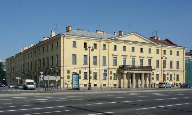
Mining University on the Lieutenant Schmidt Embankment. Night illumination of the building
The Menshikov Palace is a must-see on Vasilievsky Island. Its exposition gives a visual representation of the life of the nobility of Peter the Great St. Petersburg.
The horse-drawn carriage monument is the first thing that you see when leaving the Vasileostrovskaya metro station.
Sredny Avenue of Vasilievsky Island is one of the central thoroughfares of the island. You know, in St. Petersburg there is such a joke: "On the Petrograd side, residents walk along the Bolshoi and the Small, and on Vasilievsky Island they also walk along the Sredny."
Hotel Pribaltiyskaya on Vasilievsky Island. She used to be very beloved by Soviet bohemians thanks to the gorgeous views of the Gulf of Finland. Now the island behind her has been washed, built residential complexes and the marinas outside the window came to an end.
Western high-speed diameter spanning the city. Vasileostrovsky section of the WHSD.
Andreevsky square - a pedestrian zone of the 6th and 7th lines of V.O.
Monument to I.F. Krusenstern at the Neva on the Lieutenant Schmidt embankment. He is famous for the fact that graduates of the Kuznetsov Naval Academy, located opposite, after the final exams, put on him a huge vest made of several ordinary vests.
Street reciter at the Vasileostrovskaya metro station. Reads "Our way is an arrow of the Tatar ancient will ..." (On the Kulikovo field) by Alexander Blok.
To be continued…
Enjoy your walk through informal St. Petersburg. Your
Vasilievsky Island is the most big Island in the delta of the Neva River. The greatest length: from north to south - 4.2 km, from west to east - 6.6 km. Area - 1090 hectares. It rises above the water level (ordinary) up to 3.5 m. It is part of St. Petersburg.
In 1703-1715, the territory was almost never built up. In 1710-1720, the first stone building of St. Petersburg was built - the palace of His Serene Highness Prince A. D. Menshikov (Menshikov Palace); there were also wind sawmills on the Spit of the island. The development of the territory began in the mid-1710s, when Peter I had a plan to create on the island a city similar to the cities of Europe - St. Petersburg. According to the projects developed in 1716, 1718 and in the 1720s by the architect D. Trezzini, a network of parallel canal streets and avenues intersecting them was planned, which became the basis for further development.
Although the idea of canal streets was later abandoned, these streets are still called lines.
In the eastern part of the island and near the Bolshaya Neva embankment, the main residential and public buildings are concentrated: the building of the Twelve Collegia, the Kunstkamera, the building of the St. Petersburg Academy of Sciences and others. Since 1737, it was part of the Vasilevsky part of St. Petersburg, September 15, 1737 is considered to be the birthday of the Vasileostrovsky district of St. Petersburg. In the 1730s, the port of St. Petersburg was moved here, which contributed to further development.
The Strelka area of Vasilievsky Island has become an important architectural ensemble since the beginning of the 19th century. At the end of the 18th - beginning of the 19th centuries, almost all scientific and educational institutions of the city were concentrated on the island: the St. Petersburg Academy of Sciences, the Library of the Academy of Sciences, the Academy of Arts, the Mining Institute, the Marine Cadet Corps, the St. Petersburg University.
In 1843-1850, the first permanent bridge across the Bolshaya Neva (Blagoveshchensky Bridge) was built, connecting Vasilievsky Island with the Admiralty side. In the second half of the 19th - early 20th centuries, active housing construction was carried out on the island, new public buildings appeared. In the southern and northern parts of Vasilievsky Island, a number of large industrial enterprises arose (factories: Trubovochny, Siemens-Halske, Kabelny, Siemens-Schuckert and others, the largest is the Baltic plant). In 1917, Vasilievsky Island and the neighboring Golodai Island (now Dekabristov Island) became part of the Vasileostrovsky District (in 1936-1961, a part of Vasilyevsky Island to the west of the 12th and 13th lines formed a separate Sverdlovsk District).
In the 1920s. the reconstruction of the western part of Vasilievsky Island began. During the blockade of 1941-1944. many wooden buildings on Vasilievsky Island were dismantled for fuel. In 1950-1960, the construction of the Harbor area and the reconstruction of Bolshoy Prospect of Vasilyevsky Island continued. At the end of the 1960s, the formation of a new district in the western part of Vasilievsky Island, which is the marine facade of St. Petersburg, began (being built on the alluvial territories, project manager is architect S.I. Evdokimov, later - architects V.A.Sokhin and V.N.Sokolov ), it includes the Marine Station, the Pribaltiyskaya Hotel, the Sea Glory Square ensemble, the Morskaya Embankment. Currently, work is underway to further expand Vasilievsky Island towards the Neva Bay, and the first stage of the new Seaport has already been built.
Vasilievsky Island is connected by the Blagoveshchensky and Palace bridges with the city center (Admiralteisky Island), Tuchkov and Birzhevsky - with the Petrogradskaya side, four bridges - with the Dekabristov island. It is planned to build a new bridge in the alignment of the 22nd-23rd lines. The Vasileostrovskaya metro station is located on Vasilievsky Island. Station "Primorskaya" is often considered to be located on the same island, but in reality it is located on the island of Dekabristov. On May 27, a 300-meter tunnel with a travelator was put into operation, leading to the Sportivnaya station from Vasilievsky Island and passing under the Neva.
The island is connected by land by public transport with Nevsky Prospekt, Krasnogvardeisky and Primorsky Districts and, Finland Station, Moskovsky Prospekt, Narvskaya Square and Kupchino.
Vasilievsky Island is the most contrasting area of St. Petersburg. Pre-revolutionary buildings with original courtyards, in which front gardens, wooden porches, one- and two-storey outbuildings have been preserved, are adjacent to block houses. working townships of Stalin and gray Khrushchevs of the Soviet period.
There are few green zones, the most green areas of Vaska are the courtyards of the Harbor. The role of the park is forcedly performed by the Smolensk cemetery.
In this area, the most preserved wooden houses than in the other part historic center Petersburg.
The popular name of the island is "Vaska".
-Where do you live?
- On Vaska.
"I don't want to choose either the country or the churchyard
I will come to die on Vasilievsky Island "
(Joseph Brodsky, 1962)
Spit of Vasilyevsky Island
the site will tell you which recreation areas to visit and historical places on Vasilievsky Island.
Where is Vasilievsky Island in St. Petersburg
Vasilievsky Island is located in the Neva delta, in addition, it is the largest island of all. The sights of the island are located mainly along the embankment of the river. The Bolshaya Neva, which washes it on one side, and on the other side is the Gulf of Finland, the Malaya Neva and Smolenka rivers. It is worth remembering that you will only be able to visit Vasilievsky Island during the day, since bridges are raised every night to ensure the passage of river and sea vessels along the Neva.
Places for walks on Vasilievsky Island
Rumyantsev Garden - it will be possible not only to walk, but also to listen to music. Concerts are held here every Sunday in summer. You can also see the obelisk dedicated to the victories of Field Marshal Count P.A.Rumyantsev during the Russian-Turkish war of 1768-1774.
Address: Rumyantsevskaya Square
Garden of the Academy of Arts - cozy place for walks with children. Horses and ponies are brought here, on which you can ride.
Address: Universitetskaya embankment, 17, 3rd line of V.O., no. 2, 4th line of V.O., no. 1-3
Dragon courtyard - favorite place residents of Vasilievsky Island. Moreover, the townspeople call this dragon "Vaska". This sculpture appeared in the 1980s.
Address: 8 line, 23, actually between Bolshoy prospect, 7th and 8th lines
Park "Vasileostrovets" is a good place for family walks. While the children are having fun on the slides, parents can visit a cozy restaurant in the park. In addition, there are entertainment activities for children.
Address: 25th line, Sredny pr., Bolshoi pr.
Opochininsky Garden is a small area where flowers are planted, there are playgrounds. Also in the Opochininsky Garden, the Alley of Love was laid, which is popular with newlyweds.
Address: between Nalichnaya street and Opochinina street.
Park of the Decembrists - the park was laid out presumably at the burial place of five executed Decembrists. Interesting place in order to learn the story. It should be noted that there is a memorial stele in the park.
Address: between Uralskaya street, Nalichnaya street, KIM avenue.
Lieutenant Schmidt Embankment - the Krasin icebreaker is located here. Arctic icebreaker of the Russian and Soviet fleets, since the 1980s - a museum ship, built at the W. G. Armstrong, Whitworth & Co. Ltd. in the city of Newcastle upon Tyne in Great Britain in 1916 - 1917. In 1927 it was renamed in honor of the Soviet politician Leonid Krasin (1870 - 1926).
Address: Lieutenant Schmidt Embankment.
Smolenskoe cemetery - despite the specific location, the inhabitants of Vasilievsky Island note that this is the most the best place on the island. It is interesting to go for a walk in the historical part of the cemetery; many famous Petersburgers are buried there. The Chapel of Xenia the Blessed is also very popular.
Address: both banks of the Smolenka River
Spit of Vasilyevsky Island
The arrow is called Eastern Vasilievsky Island. The narrowest street - Repin (its width is about six meters) and one of the most beautiful streets of Northern Palmyra - the 6th and 7th lines - run here.
One of the notable structures of Vasilievsky Island are two 32-meter Rostral columns located on the sides of Birzhevaya Square. They were built in 1810 by the French architect Jean-François Thomas de Thomon. Previously, they acted as beacons for ships entering the port. At the foot there are allegorical figures that represent the four rivers of Russia: Volga, Neva, Dnieper and Volkhov.
Another attraction is the Gottorp Globe. It was installed under the Empress Elizabeth Petrovna. But in December 1747 it was destroyed by fire. which arose in the building of the Kunstkamera and began to be restored the following year. Currently, it can be seen in the exposition of the Museum. M.V. Lomonosov.
Tourists often visit the Church of the Three Saints, founded at the beginning of the 18th century and which is one of the oldest in the entire city.
The Central Naval Museum is also worth a visit. Of all the thematic museums in the world, it is the largest.
Cafes, pubs and restaurants of the island
Buterbrodskybar - Makarov Embankment, 16
Belgian Gastronomic Pub Bruges - Makarov Embankment, 22
Wine bar Brothers Tonet - V.O., Birzhevoy lane, 4
Muk restaurant - st. Havanskaya, 35
Chirdak restaurant - Nakhimov street., 5
Photo: "VK" Vasilievsky Ostro (Vaska "," VK "" Vasin Sad ", KudaGo, cittywals
Video: "VK" user Valery Medvedev